
RCC leverages advanced UAS technology to safely capture aerial imagery and LiDAR tailored to your project requirements
Our UAS Services
-
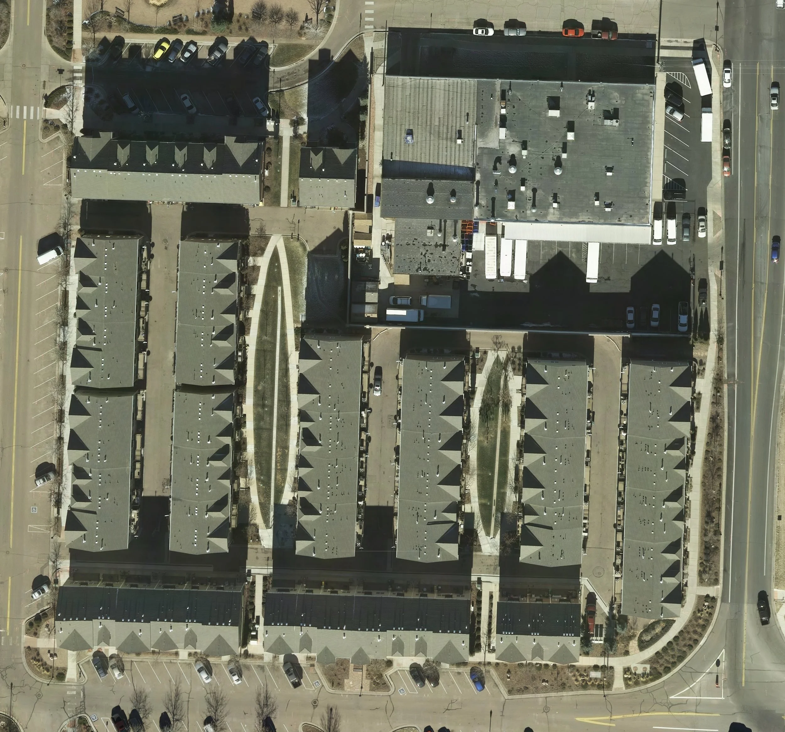
Aerial Images
We can provide aerial images of your property management needs
-
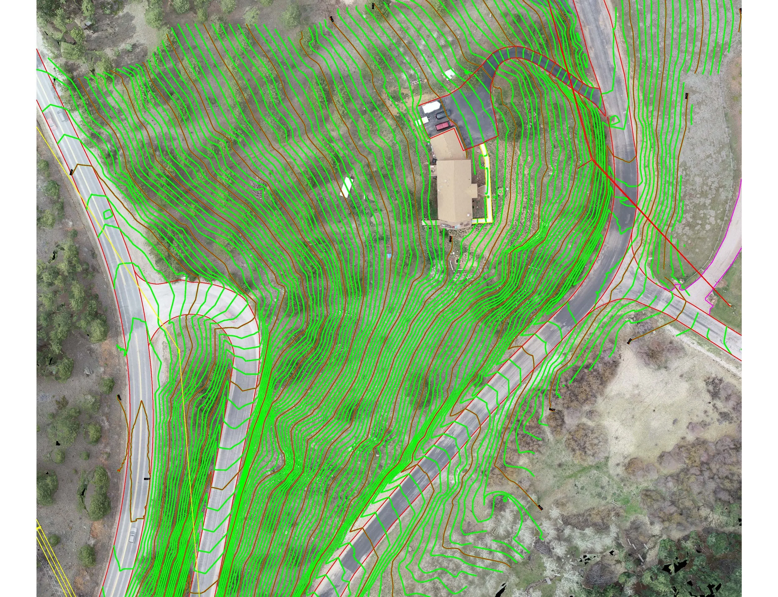
Aerial Surveys
We can provide Topo Graphic map of your site using Aerial imagery or LiDAR.
-
Aerial Video
We can also provide Aerial video for construction monitoring and Marketing.
-

Historical Preservation
We can provide documentation for historical preservation